
AI & Satellite Imagery: What Goes on in the Depths of the Ocean?
The ocean has always been a vast and mysterious expanse covering over 70% of the Earth’s surface. Historically, understanding what goes on beneath the waves has been as elusive as it has been fascinating. But now, thanks to the remarkable convergence of artificial intelligence (AI) and satellite imagery, researchers have peeled back the ocean’s blue veil.
This latest research offers a historic and exclusive glance into marine activities with unprecedented precision.

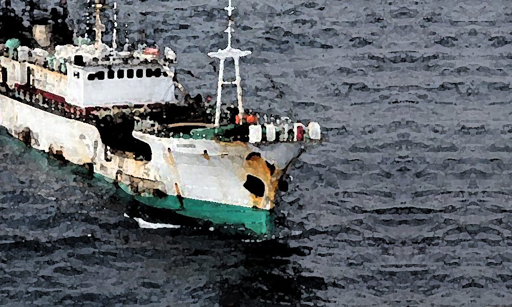
Elle / The research was backed by the Google-backed nonprofit Global Fishing Watch.
A New Era of Ocean Monitoring
The research was spearheaded by the Google-backed nonprofit Global Fishing Watch and published in the prestigious journal Nature. It represents a watershed moment in marine study. By harnessing the power of satellite imagery coupled with advanced AI algorithms, scientists have mapped human activity at sea with a level of detail that was previously unthinkable.
Thus, this effort has exposed a staggering amount of industrial activity that has long escaped the public eye.
Uncovering the Hidden Activities
One of the most striking revelations from this research is the extent of industrial fishing operations. The study uncovered that a whopping three-quarters of the world’s industrial fishing vessels are not publicly tracked. This finding is particularly alarming as it raises questions about the sustainability and regulation of global fish stocks.
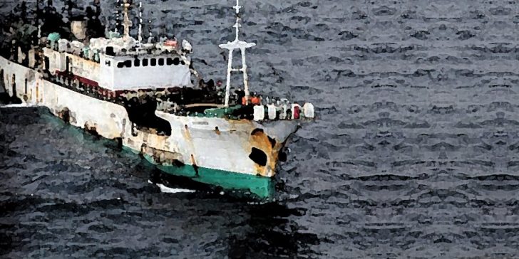
GTN / The research – published in the journal ‘Nature’ – highlights industrial fishing operations in the ocean.
Moreover, the research highlighted that up to 30% of transport and energy vessels also avoid public tracking. These blind spots in monitoring could significantly hamper global conservation efforts.
What Is the Importance of Visibility?
For decades, the lack of visibility into ocean activities has been a significant barrier in marine conservation. The ocean’s sheer size and the vast distances involved have made tracking and monitoring a daunting task. However, with the latest advancements in satellite technology and AI, researchers can now track vessels’ movements and activities with remarkable accuracy.
This increased visibility is crucial for policymakers and conservationists. So, to effectively protect the world’s oceans and fisheries, it is essential to have a precise understanding of where and how resources are being exploited.
AI and Satellite Imagery: A Game Changer
The integration of AI with satellite imagery is a game-changer in oceanic research. AI algorithms are adept at analyzing the massive amounts of data generated by satellite images.

Asad / Pexels / Deep learning and satellite imagery can identify patterns and anomalies that would be impossible for humans to discern.
This capability allows for the detection of illegal fishing activities, unreported shipping routes, and even previously unknown areas of industrial development.
The Future of Ocean Conservation
This groundbreaking research has far-reaching implications for ocean conservation. With better tracking and monitoring capabilities, it is now possible to enforce fishing regulations more effectively, identify illegal activities, and develop more informed policies to manage ocean resources sustainably.
Furthermore, this technology could be pivotal in protecting endangered marine species and habitats by providing real-time data on environmental threats.
While this research has shed light on previously hidden aspects of ocean activities, it also serves as a clarion call for urgent action. The fact that such a significant portion of industrial activity at sea has remained unmonitored is a stark reminder of the challenges facing ocean conservation. Policymakers, industry leaders, and the public must work together to leverage this new technology for the greater good of our oceans.
More in Tech
-
`
 Why “The Traitors” Is Every Pop Culture Card Collector’s Dream
Reality TV rarely sparks interest in collectibles, yet The Traitors has emerged as an exception. Set in a haunting Scottish castle,...
February 4, 2026 -
`
 Venezuela Opens Oil Industry to Foreign Investment, Seeks Warmer US Ties
Venezuela is entering a new political phase under acting President Delcy Rodríguez, who used her first state of the union address...
January 28, 2026 -
`
 Florence, Massachusetts – A Village Full of Art, Food, and Views
Massachusetts is known for its rich history, scenic coastlines, and vibrant towns. Just outside Springfield lies Florence, a small village within...
January 21, 2026 -
`
 How Showers and Baths Keep Data Center Technology Cool
Data centers operate nonstop, running thousands of computer chips at high speeds. The heat these systems generate can be intense, yet...
January 14, 2026 -
`
 The Pop Culture Reference ‘Gilmore Girls’ Creator Refused to Cut
The fast-talking world of ‘Gilmore Girls’ has always stood out for its sharp dialogue and dense pop culture drops. From literature...
January 7, 2026 -
`
 This Celebrity Burger Brand Is Hitting the Road With Food Trucks
Food trucks have revolutionized the restaurant scene, providing a flexible way to reach hungry customers without the high costs associated with...
December 31, 2025 -
`
 12 Must-Visit Stops on a Vancouver–Seattle Road Trip
Embarking on a road trip from Vancouver to Seattle is more than just a drive—it’s a journey through some of the...
December 25, 2025 -
`
 What 2025’s Green Investment Boom Means for the Global Economy
The global economy in 2025 has reached a defining moment. Green investment is no longer a niche interest but a driving...
December 16, 2025 -
`
 How to Turn Business Values into Real Workplace Culture
Every company loves to talk about its values, those bold statements displayed on office walls, websites, and annual reports. Yet too...
December 10, 2025
More From Todaysnyc
-
 Grindr CEO Aims to Turn Dating App Into a Full LGBTQ+ Culture Hub
Grindr has long been recognized as one of the most widely used dating apps for gay men. Today, the company is...
CultureJune 23, 2026 -
 How AI Is Helping SMEs Simplify Expense Management
Expense management is becoming a key pressure point for businesses as spending patterns grow more complex and harder to track. A...
BusinessJune 16, 2026 -
 Best Places to Visit in Greece Beyond the Famous Islands
Greece has long captured the imagination of travelers with its ancient history, island culture, dramatic scenery, and vibrant local life. While...
Luxury & Life StyleJune 11, 2026 -
 Blockchain and Crypto’s Growing Role in U.S. Military and National Security
Cryptocurrency often sparks debate around finance, regulation, and digital investing. Yet the technology behind it may have an even bigger role...
TechJune 3, 2026 -
 NYU Commencement Speech Sparks Dispute Over Cancel Culture Critic
A planned commencement address at New York University has sparked a heated campus dispute, placing scholar Jonathan Haidt at the center...
CultureMay 28, 2026
You must be logged in to post a comment Login